Hurricane Irma made landfall Sunday in the Florida Keys, with observed gusts of wind up to 130 mph. It is the first time in American history that two Category 4 hurricanes have hit U.S. mainland in a single season, according to the Weather Channel.
Big Pine Key, Summerland Key and Cudjoe Key in the eye of Hurricane #Irma. Do not venture outside https://t.co/tW4KeGdBFb @NWS @NOAA pic.twitter.com/0qlPQqG7Zi
— National Hurricane Center (@NHC_Atlantic) September 10, 2017
The center of Hurricane Irma made landfall at Cudjoe Key in the lower Florida Keys at 9:10 a.m. Eastern Daylight Time. A gust up to 106 mph was first reported at the National Key Deer Refuge in Big Pine Key.
Beyond powerful winds, the hurricane has risen the sea level in Key West by three feet, according to the National Weather Service.
Irma’s second landfall is possible in Southwest Florida later today.
Progression of Hurricane #Irma over the last 6 hours as viewed by #GOES16. pic.twitter.com/xb8xBb35oN
— NASA SPoRT (@NASA_SPoRT) September 10, 2017
Florida utility officials predict more than 1 million customers will lose power as Hurricane Irma thrashes the state, according to the Associated Press.
Florida Governor Rick Scott already ordered an evacuation for most of south Florida last week.
“If you’re in an evacuation zone, you’ve got to get out; you can’t wait,” Scott said Friday in an interview with ABC News’ “Good Morning America.”
“This thing’s coming,” he warned. “It looks like it’s going to go right through the middle of our state.”
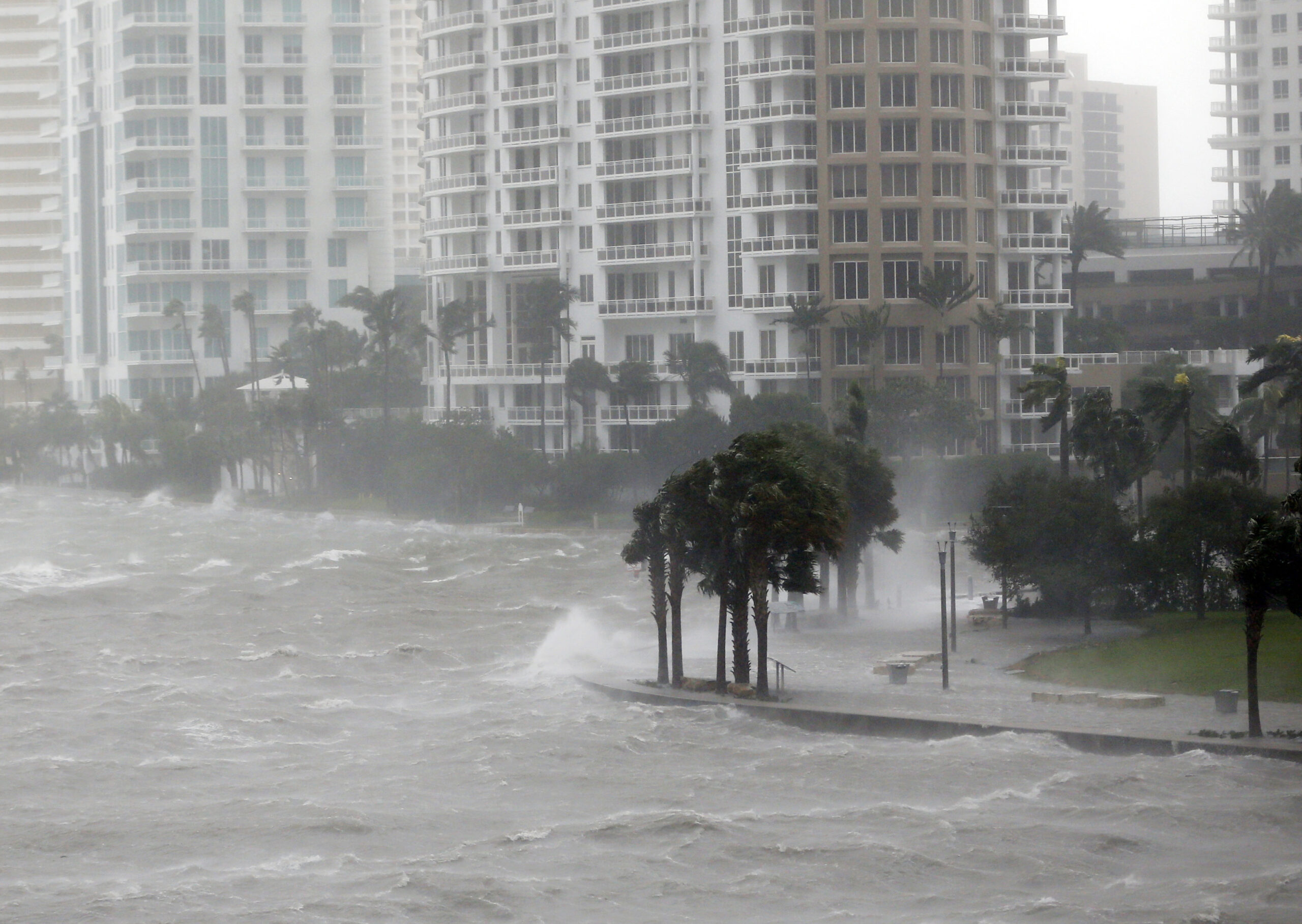
Weather Channel is reporting that there are still people inside Miami’s high-rises riding out the storm, defying evacuation orders.
About 1,000 volunteers with the American Red Cross are stationed in Florida, Scott said Friday, and an additional 9,000 people have also volunteered to help.
