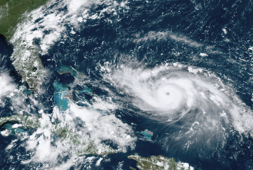
Hurricane Dorian made landfall on Sunday afternoon, with the Category 5 storm hitting the Abaco Islands in the northwestern Bahamas with winds around the eye of the storm reaching up to 185 miles per hour.
The hurricane struck land at roughly 12:45 PM ET, according to The New York Times. The National Hurricane Center described the storm as being “catastrophic” in nature with “devastating winds.” The storm is expected to continue impacting near or over Grand Bahama over the next day or two, with as much as 25 inches of rain and storm surges of up to 23 feet that could swamp low-lying areas of the island. Perhaps most ominously, the National Hurricane Center noted that it had recorded wind gusts in excess of 220 miles per hour, the strongest on record in the history of the Bahamas and more than three times the speed necessary to qualify as a hurricane.
Bahamas Prime Minister Hubert Minnis said on Saturday that 73,000 residents and 21,000 homes were going to be affected by the storm.
Although meteorologists aren’t sure if the hurricane is going to hit the United States, given that its track could keep it closer to the shore, it could still wind up impacting North Carolina, South Carolina, Georgia and Florida.
Dorian is already shaping up to be a historic hurricane. Since 1950 the only Atlantic storm to have stronger sustained winds than Dorian was Hurricane Allen in 1980, according to CNN. The network also reports that tropical storm-force winds will start to hit Florida on Monday morning, starting in the West Palm Beach/Port St. Lucie area before moving into the central part of the state. It will eventually hit the West Palm Beach and Port St Lucie area, but by Tuesday will have weakened to a Category 4 storm. Despite that it will still be dangerous as it pushes forward toward the coasts of Georgia, South Carolina and North Carolina.
In political news, President Donald Trump’s famous Florida resort Mar-a-Lago has had to evacuate as a result of the impending hurricane. Last week former Canadian Prime Minister Kim Campbell aroused controversy when she tweeted “I’m rooting for a direct hit on Mar a Lago!” according to The Washington Post. She later clarified that in a follow up tweet, “Well, we will see if Mrs. Post’s design can stand up to the assault! I know Palm Beach well and am sorry if it gets a big hit. I wish I cd believe that it wd shake up Trump’s climate change denial! Only today his admin has removed regs to limit methane- a worse GHG than CO2!”
According to Kristy Dahl, senior scientist at the Union of Concerned Scientists, climate change effects hurricanes by fueling them with warmer water, extends storm surges due to rising sea levels and increases rainfall because of warmer air holding more moisture.
“As the climate continues to warm, the strength of tropical cyclones (including hurricanes in the North Atlantic) is projected to rise. The projected increase in intense hurricanes is substantial—a doubling or more in the frequency of category 4 and 5 storms by the end of the century—with the western North Atlantic experiencing the largest increase,” Dahl writes.
